Wednesday, October 31, 2007

Bicycle Commuting is Alive and Well…


10.31.2007


Day 36


Wellington


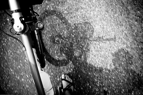
…In Wellington. We spent the day touring the city and to our delight saw many people navigating their bicycles around the streets.

Before I review the day, I wanted to give Chris a big HAPPY BIRTHDAY shout out. Today is his 33rd birthday.

We left the campervan behind today and took the bus downtown. I’ve always been a fan of using public transportation to see big cities. So far we’ve been able to get around pretty well in all the cities we have toured.
Our tour of the city basically focused on a 1.5km area. We started by riding the cable car up the hill above downtown to the botanical gardens. From there we worked our way back to town by strolling through natural looking areas of native and imported species. We eventually wound our way around to the Lady Norwood Rose Gardens. Unfortunately, the roses were not yet in bloom, but you could sense how beautiful the 100 different varieties would be.
We continued our walking tour back into the city center through an old cemetery. It seemed to be a well frequented place, with many people walking and running on the path. After crossing the motorway we came upon our next activity, a tour of the parliament buildings.
The start of the tour was different than what you might expect. Our guide first took us to the basement to show us how the building was retro-fitted in the mid 90s to withstand earthquakes. The Parliament House and the Parliamentary Library were essentially separated from their original foundation and put on 400 rubber “springs”. This technique, called base isolation, is supposed to “reduce the transfer of earthquake forces from the foundations to the building above…”. In the end, it reduces the need for strengthening the walls in the buildings themselves. It was quite a feat of engineering. Another highlight was the tour into The House of Representatives Debate Chamber. We got a good overview of the protocol and traditions that have been going on since the 1850s.
Our final sight of the day was Te Papa, the national museum of New Zealand. Having learned from previous museum experiences, we picked just a couple of exhibits to view. Since the landscapes are so dramatic in New Zealand, we picked the Awesome Forces exhibit. It wasn’t your run of the mill collection of glass-cased enclosures. We were treated to a whole range of interactive displays focusing on how the forces of nature have shaped the landscape of this island country. Most intriguing was a copy of the first seismograph developed in 132 A.D. coming from China.
Finally we celebrated Chris’ birthday in style at the Wellington Brewing Company (of course). We sampled their local brew, Sassy Red, with standard pub fare. It was a fitting end to our tour of this very hip and cosmopolitan city.
Tomorrow we’re off on the ferry and the start of a new adventure on the South Island.
LK

Trout-o-rama and random thoughts

10.30.07
Turangi to Wellington

We headed out of Turangi at the crack of 10:30 this morning. Our guide, John, from yesterday dropped by to give us a disk of our pictures and to tell us happy travels. We then got the campervan loaded up and headed out to the Tongariro Trout Hatchery to tour the historical grounds and check out the fly fishing museum on site. They have a great fly rod display with reels from 1898 and lots of split cane rods on display. Very cool stuff. The hatchery doesn’t put any fish into the Lake Taupo/Tongariro Drainage, but instead sends the trout off to the other fisheries around the North Island. The trout in the Taupo/Tongariro area are all wild, descending from trout introduced in the 1880’s-1890’s. The rainbow trout were introduced from the Russian River in Northern California and the brown trout were introduced from Scotland via Tasmania in Australia.
Nerdy information, yes, but I found it quite interesting.
We had a nice drive south today. The highway south of Turangi is referred to as “The Desert Road”. If you have seen any pictures from our trip so far, you can see it isn’t even close to a desert. You can imagine my surprise when we drove through 30 kilometers of desert south of Turangi. We couldn’t figure out if was due to a rain shadow effect from the volcanoes nearby or a scorched earth area resulting from those volcanoes. It was pretty desolate though.
It is a pretty small world down here. I was in the bathroom brushing my teeth before I turned in for the night and ran into a guy I had spoken briefly to in Russell a week ago. He is heading over to the south island tomorrow and doing close to the same circuit we are looking at. I wouldn’t be surprised to run into him and his wife again.
Tomorrow is my 33rd birthday. I have a thing about being an age divisible by 11. I think it will be a good year.
CK

Shangri-La


10.29.2007

Fly-fishing the Manganui a te Ao


Hanging gardens and steep canyon walls. Deep pools and bubbling cascades. Clear turquoise water. Clear skies and perfect temperatures. Big, beautiful fish.

We celebrated Chris’ birthday a few days early with a guided fly-fishing trip. We hired a guide named John Somervell who specializes in back country trips. It was awesome. We fished the Manganui a te Ao River. To the Maori the name means “Big River of the World”. The entire landscape was amazing and the view seemed to get better around every corner. We had the river (and the fish) to ourselves. John patiently and thoughtfully guided us up the river. He was the perfect compliment to our setting – a seasoned guide with a passion for the outdoors. I’m sure we were very spoiled and we’re very pleased to have shared the day with him.
We caught wild rainbow and brown trout – there are no stocked fish in this area. Ranging from 2-4 lbs, Chris and I caught the biggest trout since we’ve been casting a line. I learned quite a bit throughout the day about how to handle bigger fish.
The most unexpected part of the day was what I felt when I returned the fish to the water. It was rather surreal – holding the fish in the water, cradled in my hands. At the very moment the fish swam away, I felt a real connection with my surrounding environment.
I think it’s what we call “in the moment”…

Spritzers, Sandwiches, and Singletrack


10.28.2007
Turangi Day 3


We (Kathy and I) had a pretty mellow day checking out the town of Turangi and walking along the Tongariro River. Don and Leslie went on a hike on the bottom part of the famed track (famed in New Zealand anyway): The Tongariro Crossing. I dropped them off at 8:30 this morning and left them until 2:00 this afternoon. The complete hike takes about 8 hours and spends a lot of time above timberline. The trail conditions right now are snow packed up high and they recommended that crampons and an ice axe be carried just in case. Leslie and Don made it to the lower hut before turning around. When we pulled up to get them this afternoon they were resting under the rain shelter in the parking lot. Their faces lit up when Kathy and I busted out fried chicken, chips (french fries) and ice tea.
While the other two were off hiking Kathy and I checked out the monthly market (interesting and bleak all at the same time) and took a walk on an angler’s access trail up the river. The Tongariro River is set up to access on foot easily along a 7 km stretch upriver from town and several kilometers down river to Lake Taupo. The trail is open to bikes as well so I scouted it out a little bit for Leslie and I later. Kathy and I hiked just under 2 hours total before we had to hustle back to get the other two at the trailhead.
When we returned to the condominium Leslie and I donned our bikes and rode a bit of trail for 10 kilometers or so. The highlight of the trail was the two river crossings on narrow suspension bridges 25’ above the water. We rode them and it was a little spooky looking at the cracks in between the boards all the way to the crystal blue water below. Thank goodness the bridges didn’t sway too much.
We decided to do a leftover night for dinner tonight. Cold cuts, salad and plum liqueur spritzers hit the spot. Life is tough.
CK

Saturday, October 27, 2007

Taupo and the Central Plateau

Day 32

Turangi/Taupo


We’ve landed in Turangi for a few days. We have a nice condo (thanks to my parents) and a chance to spread out, relax and re-organize our gear.
We’ve also seen a dramatic change in the landscape. Instead of mile upon mile of rolling hills, we can now see the largest lake in New Zealand back dropped by snow-capped volcanoes. The views are definitely vast and the setting is appropriate for the most active volcanic region in New Zealand.
The three volcanoes and surrounding area that make up Tongariro National Park were a gift from the Maoris. Rather than risk their sacred lands to forestry and development, chief Te Heuheu, a paramount chief, gifted the area “to the Crown and the people of New Zealand” in 1887. The original gift of 2,360 hectares is now 79,598 hectares. In recent times, the mountains have played important roles as Mt Doom and Mordor in the Lord of the Rings trilogy.
Lake Taupo is the heart of the area and was created during a volcanic eruption that occurred over 26,000 years ago. The 606 sq kilometer lake now plays host to a variety of activities, including world-class trout fishing.
Our day was pretty mellow. After breakfast we made the short drive back to Taupo and spent a few hours checking out Huka Falls and the Honey Hive. Huka Falls is part of the Waikato River, the longest in New Zealand. The river is as useful as it is scenic and provides 25% of New Zealand’s hydro power and 15% of the country’s total power. The river originates from Lake Taupo and water levels are controlled above Huka Falls. We observed the falls from several different viewpoints. The river transitions from 100 meters wide and 4 meters deep to 15 meters wide and 10 meters deep. It’s hard to describe the power and energy that we witnessed. I thought it looked like a waterpark ride on steroids that would result in certain death. We’re still trying to figure out if anyone has ever run this section in a kayak.
The Honey Hive was definitely a more mellow sight. It was basically a gift shop and café with a working bee hive. Using glass boxes and clear tubing, the hive was staged both outside and inside the building. It was mesmerizing to watch the bees going about their daily business.
The calm weather is supposed to settle in and we’re looking forward to some exciting outdoor activities in the next few days; hiking in Tongariro National Park and backcountry fly-fishing for wild trout.
Until then…
LK

Ps – I’m still jazzed about the bungy we did yesterday. Hopefully we can put up a short video soon.

Friday, October 26, 2007

Tunnels and Love


10.26.07
Waihi to Turangi
260 kilometers

We awoke to some lovely southern wind this morning. We actually were rocked all night long in the motor home by it. We had wanted to hike a along the Karangahake Gorge, but weren’t too sure about the wind. We wondered around a bit trying to find the car park, but eventually found it. Leslie and I were expecting something like Black Canyon or Royal Gorge, but found a pretty subdued little narrow river valley instead. The guide said the highlight of the hike is a walk through the mountain in a 1 kilometer long abandoned train tunnel. We weren’t expecting to give it a go since the wind was blowing, but the valley was quite sheltered. I just happened to grab a jacket that had my head lamp in it, which came in handy later. We had a great hike along an abandoned pipe line on the gorge and eventually came to the tunnel we had read about. The book said that head lamps weren’t necessary since the tunnel was lit, but vandals and nature had taken care of all but about 20 bulbs along the length of the tunnel so we were all huddled around the little light as we made our way through. All was well and we did end up back at the RV around an hour later. The hike ended at some old leach vats for the local gold mines. The gold mines in that area produced around 5,000,000 ounces of bullion over a 40 year period.
After our hike we stopped in Paeroa for a meat pie and and L&P Soda (Lemmon and Paeroa). Paeroa just stands for the town it is made in and not any flavor in it. The soda is touted as being “World Famous in New Zealand”, and I would have to say that it is an acquired taste, but pretty good.
After our meat pies and L&P we were off to Taupo. Leslie has been talking it up about bungee jumping here in Taupo and today was the day. The “Taupo Bungy” is 47 meters high and is off a cantilevered platform above of the Waikato River. I had been thinking about jumping with her and as we pulled into the parking lot I decided I should give it a go. We were both too spooked to jump alone, so we decided to do it “lovers leap” style. Our ankle harnesses were strapped together and we shuffled to the edge in an embrace. The jump master counted to three and we fell forward into nothing. We did opt out of the “water touch option” so we stayed dry and were safely lowered into the rescue boat on the river. Leslie and I did opt for the picture and video package. Now whenever we get the urge to do it again, we can just watch the video. A much cheaper option.
CK

The Coromandel Run

Coromadel Town to Waihi
Distance: 153 kilometers

We completed our tour of the Coromandel Peninsula today. We saw some pretty spectacular scenery. In addition to beautiful beaches and high mountains, the Coromandel Peninsula has some rich history in gold mining, kauri logging and gumdigging.
Our day started in Coromandel Town with Chris behind the wheel. He guided us over the mountains and down the twisting roads to the east coast. Our goal was to hike to Cathedral Cove. We figured that it would be important to get some exercise each day since we are now spending time off the bikes for the next two weeks.
The view from the car park was jaw dropping. The limestone cliffs rise up out of the crystal blue waters in both directions. It was definitely “all that and a bag of chips”. We quickly got our things together and started along the walking path. We hiked just above the cliffs for most of the way with great views of the islands just off the coast. The area is part of the sixth largest marine reserve in New Zealand. The cove is a giant limestone archway that connects two beaches. The photo opportunities were great and we spent the better part of an hour walking around taking in the views.
Lunch was served as a reward after the trek back to the campervan. Chris fixed up the leftover smoked mussels and marlin with crackers and cheese. Yesterday we stopped by the popular Coromandel Smoking Company to sample the local seafood. We sat and chatted about how Cathedral Cove ranked on our list. We all decided it was pretty darn high.
Leslie drove the second shift to Waihi and decided that it is just as hard to drive the hilly, twisting roads as it is to ride them.
The “Wiki Bus” moves on to Turangi tomorrow. Stay tuned.
LK

The in-laws have landed

10.24.2007
Day 29

Leslie’s parents got into Auckland around 7:00 this morning. Leslie and I picked up the RV yesterday (Leslie’s trial by fire yesterday was quite funny) and we spent last night near the airport. Don and Kathy looked pretty good considering they just got off a 12 hour flight so we decided to pack them up again and whisk them off to the supermarket. Leslie and I realized that the stores and their contents are old hat to us and we had to slow down take a look at things with Don and Kathy. We have never spent that much time in the stores since we never had the means to carry a lot of food. A little while later we were off to the fabulous Coromandel Peninsula and some curvy roads. I drove out of Auckland this morning to a cool little mining town called Thames (home of Thames School of Mines) where we switched drivers. Leslie then had to drive our RV on a narrow road along the coast with no shoulders or guards while we held on in the back and tried to keep the cupboards shut. We got into Coromandel Town for the night and saw a little smokehouse on the out skirts. We had read about the smoked mussels that were available there so we decided to see what they were all about. They do deserve to be written about. I also picked up a smoked marlin steak for lunch tomorrow. I love refrigeration.
Our ride yesterday through the city was pretty short, so I felt like I needed to get out today. We did talk about riding a little when we got to Lake Taupo in a couple of days, but I think I may have to pedal a little before then. I will let you know how the marlin is.
See you later
CK

Tuesday, October 23, 2007

Transportation x 4


10.23.2007

Day 28

Auckland


Bike, boat, bus, bike, campervan – in that order. Four modes of transportation got us back to Auckland today. We started the day by riding to the ferry dock at Russell. The fifteen minute ride across the bay was very calm and serene. We then got on the Intercity bus to Auckland and four and a half hours later we were smack dab in the center of the city. A month ago I wouldn’t have been caught dead riding my pannier laden bike through a city with millions of people. Don’t get me wrong, I was still nervous, but we can handle our bikes much better now. The ride was not bad at all – maybe because we were not on a highway and the drivers couldn’t go their usual “warp speed”. We followed a map that we picked up called “Getting Around Auckland Cycle Map”. We started out along the container wharf on a designated bike path and then shared the bus lane (interesting because cars are parked here) all the way across the city. We actually came full circle when we rode past the Skyway Lodge, our home for the first two nights in New Zealand. Overall, I’d say it was a pretty good adventure.
Our next escapade began when we picked up the campervan. Leslie’s parents arrive tomorrow and we decided it would be the most logical, cost-effective way to travel. I think we got the logical right, but maybe not the economics. Anyhow, we should have some funny stories to tell after they leave. I got to be the first driver and was christened with a drive through rush hour to the campervan park. Coupled with the fact that I was driving on the opposite side of the road with a manual transmission, you can imagine that I enjoyed my first glass of New Zealand chardonnay when we arrived at our campsite.
LK

Russell-Rest Day 3


10.22.07


We were a little bit restless in town today. This is the longest time we have spent in one place since arriving in New Zealand. This is the Labor Day (or Labour Day here) weekend here and Monday is a national holiday. All the people up from Auckland for the boat race left this morning so the town was pretty dead this afternoon. We did manage to get out on a little ride to the car ferry dock in the next town over. We thought the town would be on this side of the bay, but it was just the dock. We lucked out and found a new walking track near the dock and had a nice little one hour hike through a kiwi bird conservation area. The trail ended at a little secluded cove called Pipiroa Bay where we had our last can of tuna. We had been putting it in the bottom of the bag for a little while now. We did spice it up with a little cheese so it went down a little easier.
We are off to catch the bus early in the morning. We have to catch the ferry at 7:00 am to make our 8:00 am bus to Auckland. We were out of groceries as of this morning so rather than hit the store we opted for dinner at the Duke of Marlborough Hotel here in Russell. It has the distinction of being the first licensed hotel in New Zealand. The ambiance was pretty cool and the food was really good. We did splurge and have a couple of beers with dinner.
I have been taking Chinese language lessons online for a couple of days now. I figure I should be able to say a couple of things before we get there. The lessons are podcasts that are free on iTunes and there are study materials available on http://www.nextgreatthing.com/. The teacher started off today’s lesson with a Chinese proverb which went “if you are not progressing, you are regressing.” He equated it to keeping up on your lessons, but I found it kind if notable to our trip. Forward progress, no matter how slow, is always a good thing.
Zàijiàn
CK

Sunday, October 21, 2007

Northland Training Camp


Russell

Rest Day 2

Minus our ride across Auckland on Tuesday, we have now finished our first tour in New Zealand. I’d like to think of it as “training camp”.
We arrived here without much long-distance cycling fitness. After a month, we finally feel like we’re in shape. The constant hills and wind and the weight of our bikes have been a challenging way to start this grand adventure. With a good little break then next two weeks, while Leslie’s parents are visiting, we should be ready to have a great time on the South Island.

As far as cycling, here is what we managed to accomplish in the first four weeks:

Distance: 703 kilometers / 436 miles
Time: 51.41 hours
Avg Speed: 13.73kph/8.51 mph

The cycling was really only half of learning curve and we managed to develop a good system for everything else that goes on in a day. Life is now simple in terms of what we have in our possession, but we still have a lot of daily tasks. We’re both “system” oriented people so we have definitely fallen into certain roles and routines. Surprisingly, I’ve really enjoyed having a routine. Here is what a typical day entails:
On travel days we wake up around 6:30 am, get dressed to ride, and haul our food and cookware to the common kitchen. Chris prepares the food (as he does for every meal) and I brew the coffee. We eat, hopefully catching the weather report for the day, and I do dishes after we’re finished. We then pack all of our panniers, disassemble the tent and load the bikes. After putting on the orange vests, we ride off to our next destination. We usually stop a couple of times to eat along the way. We’ve certainly turned into eating machines. After reaching our new home for the night (usually a campervan park) we unload the bikes, set up the tent and change into dry clothes. Dinner is again prepared by Chris, usually hot soup, pasta or rice followed by a chocolate bar for dessert. The last part of the evening is spent writing the daily blog entry and recording all of the day’s statistics (this is Leslie’s geekness in high gear). We (she) like to track all of the cycling info as well as budget items, gps location and any solar charging time.
I’m sure over time the routines will change depending on where we are. One thing is for sure – we are getting the hang of this Bicycle Geography thing.
LK

Saturday, October 20, 2007

Russell Rest Day 1 - Boaties Revenge


10.20.07

We pulled into Russell yesterday after riding from Kahoe farms. The town across the bay from Russell is Paihia. Paihia is where we get on the ferry to cross over. While we were waiting for the ferry I found out that there was a big sailing race, The Coastal Classic, which ended in Russell today. We double checked with the campground in Russell that a tent site was available and then we jumped on the ferry for our bay cruise. The gal that checked on the campground for us remarked that we would be hanging out with the boaties all weekend. The race starts in Auckland on Friday morning and ends in Russell as early as Friday evening and as late as Saturday evening. All the boats were fueled by a strong southerly wind yesterday and covered a lot of ocean. The top boats sailed into Russell at 8:00 pm last night, and the rest have been trickling in ever since.
Leslie and I were excited to see all the racing boats in Russell today. We headed down to the docks around 9:00 this morning and saw the top finishers docked from the night before. The town of Russell isn’t that big and we figured something was up last night when the music started and the parties got going around 9:30 pm. We were surprised to see that the boats transitioned easily from million dollar racing boats to party barges in a matter of an hour. The crews were still partying hard when we went to town this morning. The little harbor in Russell is jam packed with boats right now as all the different classes come in from the ocean.
The southerly wind that fueled the racers yesterday comes from the south island when they have unsettled weather. The south island has been getting snow the past couple of days and the southerly winds coming up are really cold. We have been wearing pants and jackets all day on the beach. They have even issued a frost warning on the orchards and vineyards on the north island tonight. Should be a chilly one.
Warm wishes.
CK

Friday, October 19, 2007

Back to the Bay of Islands


Day 24

Kahoe Farms Hostel to Russell

Location: 35 15’ 40.9” S, 174 7’ 33.7” E
Distance: 69.32 k
Time: 4:48:19
Avg Speed: 14.4 k
Terrain: Rolling

We reluctantly packed up our things today and headed back to Russell. Kahoe Farms has been a highlight for sure. The guidebooks pay it just a little attention and that’s probably enough. You wouldn’t want a place like that to get spoiled. If you ever travel to New Zealand and want a unique and memorable experience, visit Kahoe Farms.
We stopped in Kerikeri to do a few errands. First stop was the bike shop to see if my shifting could be adjusted. After three weeks of hills, I was down to limited gear combinations. Tim at Fat Dog Cycles was very kind to me; he cleaned and lubed the chain and adjusted the rear derailleur all at no cost. We chatted about mountain biking on the North Island while the smell of chain lube filled the air. Ah, it was like being at home…
The next stop was the Vodafone store – we decided to get the wireless broadband modem for the laptop. As many of you have read, I’ve been lost without the internet. I suppose it’s some sort of weakness, but it’s actually cheaper in the long run.
Finally, we had lunch. It’s been awhile since I’ve had a Quarter Pounder at McDonalds and it actually tasted good. It’s probably not a good idea to roll into town being really hungry.
It was late afternoon when we rolled into Paihia. While we waited for the next ferry across the bay, Chris chatted with one of the tour operators and found out that there was a big sailing race headed to Russell for the weekend. They started in Auckland and sailed up the east coast to finish in Russell. While we were excited at the prospect of seeing the race, we were a bit worried about getting a campsite. No problem, the lady was kind enough to call the campervan park for us before we headed over on the ferry. Kiwis are definitely some of the friendliest and most helpful people we’ve met while traveling.
Tonight we’re snug in our tent in Russell listening to all the boaties party around us.
LK

Kahoe Farm Day 2


10.18.2007

Wizards and Hobbits
Today we went on the “Kahoe’s Middle Earth” hike to the enchanted rock pools. Stefano, our host/cook/tour guide, cooked us raspberry pancakes and hot coffee this morning. He then got out the treasured map to the rock pools. He is quite the joker and an absolute fanatic about football (soccer). His map to the rock pools is a play on the Lord of the Rings hype that everyone in New Zealand is still riding. The hike to the rock pools headed north on the large farm property we were staying on. We headed through such familiar landmarks as Mirkwood, Fornost, The Twin Towers and Fanghorn Forest, on our way to the destination. The Twin Towers turned out to be two cell towers and Fanghorn Forest was some dense forest along the creek to the rock pools.
The hike took about two hours one way and was well worth the rest day exercise. It was a series of three pools which cascaded down a little volcanic shelf. The upper most pool is about fifteen feet long and twenty five feet wide. Stefano measured the depth of it at about fourteen feet. The lower pools are about the same size, but not quite as deep. The water was quite cold and the weather was rainy and windy so I couldn’t muster the fortitude to take the plunge. Since the pools are on private farm land, Leslie and I had the place to ourselves and had nice relaxing afternoon lounging poolside.
Stefano, being the football fanatic that he is, also is the proud host of the not quite internationally famous first football game of the year in the world. He has a small football tournament every New Years Eve near the farmhouse and the championship game is played around midnight. He figures that this area is one of the first places on earth to ring in a new year and that anywhere east of him that may be any earlier isn’t interested in football enough to hold a tournament on New Years. Sounds like some good logic to me.
Until next time.
CK

Special Places


10.17.2007

Whatuwhiwhi to Kahoe Farms Hostel
Location: 35 03’ 10.9” S, 173 41’ 10.1 E
Distance: 52.6k
Time: 3:01:33
Avg Speed: 17.0kph
Terrain: I’ll bet you can guess yourself!

If you’ve traveled a lot you’ve found those outstanding places that for whatever reason are unforgettable. We found one of those places today.
We have been retracing our route back to the Bay of Islands since leaving Ninety Mile Beach. Instead of staying at the same places we wanted to mix it up a bit. Last evening we ventured out onto the Karikari Peninsula and Doubtless Bay. Today we arrived at the Kahoe Farms Hostel. It’s in a beautiful valley that is actually the most unique area I’ve seen in the Northland. There are craggy volcanic outcroppings towering above the standard rolling green hills.
No one was around when we arrived so we had a preview ourselves and were immediately taken in by the atmosphere. Simplicity is the best way to describe it. We particularly enjoyed exploring the dining room since it listed out all of the homemade pizzas and pastas available for the evening meal.
Eventually Stefano, one of the hosts, came out to greet us. We introduced ourselves and felt very welcome right away. I was really excited about the place as we walked around and listened to Stefano talk about the history of the farm and all of the outdoor activities available during our stay. I was ready to book a second night but I didn’t want to blurt anything out and catch Chris off guard. I just sensed that we’d be missing out if we took off again tomorrow. Luckily, Chris tapped me on the shoulder as we walked into another room and whispered “I think we should stay two nights!”.
The farm has been working since 1887. It is run today by the brother and cousin of our other host, Lyndsey. We are staying in a room in the Villa, the original house. We have the place to ourselves and felt right at home as soon as we walked through the door. It’s a nice treat after spending the last week in the tent.
I think most people drive through this valley on their way to some other “tourist destination” in the area. It would be easy to do. I’m certainly glad we have the time to slow down and relax at a special place like this. It’s one of the reasons why we travel.
LK

Tuesday, October 16, 2007

Waipapakauri to Whatuwhiwhi


Location: 34 52 35.4 S, 173 23 22.2 E
Distance: 42.22k
Time: 2:21:35
Avg Speed 17.9 kph
Terrain: Rolling

We had a very nice ride this morning, using a tail wind to our greatest advantage. We headed east with this wind for 26 kilometers this morning and then took a turn north up the Karikari peninsula. We took in a lot of rolling farmland with olive and avocado orchards, vineyards, dairy cattle galore and a sheep station that stretched on for at least 18 kilometers. Mutton anyone? We covered about 44 kilometers today in about 2.5 hours and spent the afternoon lazing around, reading (I finally finished the book I started the trip with) and checked out the local beach. It was finally sunny enough, for long enough to charge our iPods and our AA batteries on our solar charger. Leslie did have her hands full keeping me away from the new bag of “Choc Chip Biscuits” though. I did manage to get a couple put away with out her knowing.
I know I have written already about the greatness of cookies, but I am still so amazed by the fact that I can get such joy by having them. Today’s selection was purchased at a little superette (corner store) in Awanui. They are from a little bakery in New Zealand and quite good. I have found that the baked goods here are really quite delicious. Yesterday on our bus tour the driver busted out some great scones (pronounced scawns here) and these great jam filled muffins. If you couldn’t tell, we haven’t been keeping up very well with our nutrition the past couple of days. Food has been on the forefront for those couple of days. I wrote in my last blog that we have been traveling lighter and not carrying too much food. I think I am shooting that theory out the window. It is really only feasible to carry two days worth of food on our bikes so we do have to be diligent of monitoring food quantities and meals left when we are in towns with a grocer. It is amazing how you can take for granted that there is always a restaurant, fast food, grocery store or corner store nearby. We are rural enough that the ability to just run down the street from some food isn’t feasible unless you want to jump on your bike and give a little 10 kilometer pedal. That distance doesn’t sound like much, but after riding for four hours, the last thing you really want to do is get on your bike again. Sometimes it isn’t a big deal, especially if the weather isn’t bad or the cupboard is really bare.
We just had one of our better camp meals of the trip. I was forced to drop the idea of what I wanted to buy and get what was available at the store. Another lesson learned.
Good bye
CK

The Top of New Zealand


10.15.2007
Cape Reinga/Ninety Mile Beach Tour

Today was a milestone for us. We took a bus tour to Cape Reinga, the (almost) northernmost point in New Zealand. This is the one place that has been on every itinerary we’ve planned. The view from the lighthouse was spectacular, one of the most impressive I’ve seen. The wind added to the wild nature of the setting where the Tasman Sea and the Pacific Ocean meet. Aside from the significance of the location, Cape Reinga has spiritual importance to the Maoris. They believe that when a person dies, their spirit departs the earth from “Te Rerenga-Wairua”.
After lunch at a scenic bay, the bus headed back by way of Ninety Mile Beach. Talk about crazy, the bus did 63 kilometers on the hard-packed sand at about 90 kilometers per hour. They drive the same wherever they go – FAST. The tour buses travel together in groups of two and take care when crossing freshwater streams. They also avoid the two hours on either side of high tide. Apparently, some vehicles have gotten stuck and been swallowed by the sand in the past.
The beach itself is quite pristine. On our right we had the Tasman Sea and on our left we had the Aupouri Forest. At 75 kilometers long and 5 kilometers wide, this area is the second largest man made forest in New Zealand. In addition to establishing the forest, the Department of Conservation also enhanced the dunes protecting the beach as well as a buffer zone in between. It seemed a bit surreal to be viewing the entire landscape from a gas powered bus.
LK

Sunday, October 14, 2007

Tears of Sorrow - Hihi Beach to Waipapakauri


Distance 50.45 k

Time: 4:09:00

Avg Speed: 12.1 k

Terrain: Wind


10.14.2007
We spent last night at a great little beach area in Doubtless Bay. We had our first stormy night in the tent with rain and strong winds. Our tent held up great and so did we. We did end up sleeping with earplugs to drown out the wind. A few days ago I decided that I was going to start carrying less food. I planned on carrying about a days worth of meals and just buying food when we pulled into the town near our camp. Yesterday morning on our way out of town I remembered that we didn’t have any dinners and only enough breakfast for one of us. I figured we would just get something in Hihi. When we pulled into Hihi I asked the campground manager if there was a store nearby. He replied “Manganui”. Leslie asked if there was a café nearby. “the whole lot is in Manganui” he answered. Well the problem was Manganui was 10 kilometers on way and we had just ridden 60+. We must of looked like whipped puppies because the camp manager offered to drive us into town when he took his daughter into work. He saved the day.
I didn’t learn my lesson though and ended up in Waipapakauri with one dinner and one breakfast. The closest store is again 10 kilometers away and we had fought wind all day. Neither one of us was too keen on running back into town for some grub. We checked into the camp and the host remarked that they were roasting a lamb for Sunday supper and that we needed to buy our tickets before six to get into dinner. I thought I had died and gone to heaven. It didn’t matter how much it was for the “Lamb Smorgasbord”, I was going to pay it. I decided to take care of business first and take a shower (it had been a few days) then the tickets to the bonanza. I ran over to the office around 3:30 to get the tickets and the host looked at me like she had just ran over my dog. “I just sold the last tickets…sorry”. I could have cried. Dinner ended up being cream of chicken with noodles and even though it wasn’t the Lamb I smiled about as I showered and shaved it was $50 cheaper.
You snooze you lose…and then you cry.
CK

Day 18 Kerikeri to Hihi Beach


Distance: 62.38k


Time: 4:20:52


Avg Speed 14.3k


Terrain: Rolling


Tonight I sit writing in the camp kitchen. The wind and rain are howling outside. We decided to brave it in a tent this evening. We just finished dinner and are waiting for the rain to let up before going back to the tent. We will see just how weather-proof it is.
We seem to be the only people staying at this “motor camp” tonight. We have all of the facilities to ourselves. The campgrounds here are very nice and well equipped. There is usually at least a common kitchen and bathhouse. The better kitchens provide pots and pans, place settings and utensils. It’s a very affordable way to vacation. Our favorite so far was Matakohe. They had a kitchen/family room setup with couches and a tv– it was quite enjoyable.
The setting here is wonderful – it’s right on the beach. We’re hoping the weather will clear by morning so that we can soak in the surroundings a bit before heading off again. We are now in the Doubtless Bay area, getting very close to the cape. The name comes from a journey that Captain Cook made here. As his ship passed by he remarked that it was “doubtless a bay”. Maybe he thought he’d have a better time in Russell…
The ride today went well. We covered a lot of ground and the riding seemed to be a bit easier. I think we’re finally getting in shape. We’re hoping to continue north one more day and then rest a couple of days. I would really like to see Cape Reinga. We will be signing up for a tour since we won’t have time to ride there and back before having to be in Auckland ten days from now.
LK

Day 16 Russell


Location: 35 15 40.9 S 174 7 33.7 E


Here is the first bit of news: After two weeks and three internet cafes, I have finally downloaded and watched the CSI season premiere. Call it persistence or call it obsession; I’m not ashamed to say that I feel some accomplishment in getting it done. Now I know that I’m still two weeks behind, but you have to start somewhere…
We spent another day in Russell. The rain finally came last evening, but cleared by morning. There was a beautiful rainbow above the bay during breakfast. We decided to move out to the campground and back into the tent. The budget needs some help right now.
After breakfast we took the ferry back to Paihia and walked to the Waitangi Treaty Grounds. As I mentioned the other day, it is the location where the Waitangi Treaty was signed in 1840. Basically, the Treaty allowed New Zealand to become a sovereign (independent) nation where Maoris and non-Maoris could work and live together as one. Before the Treaty, there was a lot of chaos in the land they called Aotearoa. The Maori tribes were fighting amongst themselves and more conflicts arose as the Europeans began to discover the area. Russell, for instance, was known as the “hell hole of the Pacific” in the early 1800s. In an effort to bring peace and protection and to avoid governance by other European nations, the British drafted a treaty that would protect the Maori and give them equal rights as citizens under the British Empire. After great debate amongst the Maori tribes, the Treaty of Waitangi was signed on February 6, 1840. The Treaty then traveled the country and many other Maori chiefs added their signatures. Some parts of the Treaty are still debated to this day, but as a whole, the document essentially created the nation of New Zealand.
The Treaty Grounds were very nice and hold some interesting buildings and artifacts related to the history that took place there. We visited the original house that was used by British officials, a Maori meeting house, and building that housed a traditional Maori war canoe. The canoe, “waka” in Maori, was 35 meters long and requires a minimum of 76 people to paddle the boat safely.
We’re really glad we took the time to visit and get a foundation for how the nation of New Zealand began.
LK

Day 17 Russell to Kerikeri


Distance: 28.21k
Time: 2:09:46
Avg Speed 13.0kph
Terrain: Rolling


Today was a typical day in the Northland of New Zealand. We started out in sun and ended with a nice little headwind. Evidently there is more to come. The low pressure systems have been lined up to take a whack at us and here comes number 3. We did finally meet with some other cycle tourists in Russell. One was a man traveling solo heading north. He was on a bit of mission since he was not phased by the weather earlier in the week. The other was a woman from Switzerland who was on her way back south. She had been where we are heading and was enjoying the benefits of the wind that has been taunting us the past week. She commented that it was hard cycling all the time since you are always exposed to the elements. Her words have rang true so far. We were commiserating tonight at the fact that after even only 30 kilometers into the wind we are just wiped out. We set the tent up when we got to camp, had a sandwich (pb and honey—no tuna today!!) and took a little nap before heading into town to go see the oldest buildings in New Zealand. The oldest European buildings I guess. A store and missionary’s house were built in Kerikeri in the 1820’s and served the incoming sailors and the Maori. You could get a blanket for the price of a pig and musket for the price of eight pigs. We then ran to the market for a dinner of salad and pull apart cheese and bacon bread. I guess it dangerous to shop while you are hungry, but it sure does taste good.
Adios.
CK

Tuesday, October 09, 2007

Day 14 Zig Zagging


Dargaville to Russell
Distance: 130 km
Time: 5 hours
Location: 35 15’40.9”S, 174 07’33.7”E

Today we cheated and rode two buses and a ferry to our next destination. We are once again trying to stay one step ahead of the weather…only time will tell. We packed up quickly this morning in Dargaville and caught the first bus to Whangarei. A few hours later we rode the Northliner to Paihia. From there, we rolled our bikes onto the ferry. We’re now happy to be in Russell, a beautiful ocean town in the Bay of Islands.
The Bay of Islands is a frequent stop on the tourist track, about 240 km northeast of Auckland. With 150 plus islands, the area is known for its sailing, dolphin swimming and bay cruises. Fortunately, development has stayed on the mainland and the islands are very natural.
The Bay of Islands also holds a great deal of historical significance. It is where European colonization started in New Zealand and it is also the place where the Treaty of Waitangi was first signed in 1840. I plan to share more on this after we have a chance to visit the Waitangi Reserve.
You might have noticed some of the names of places in New Zealand are not easy to pronounce. Our language lessons have been taken from the back of our Lonely Planet guide and listening closely to people through conversations. Many names are Maori, which is closely related to the Polynesian language. So far, it hasn’t been too hard to say the vowel combinations. It’s the special double consonants that are a bit confusing. For instance, “wh” is really pronounced as an “f”. So, Whangarei would be pronounced “Fanga-rye”. Between the Maori names and the Kiwi accent, we have been fully immersed in the culture here.
LK

Day 13 Matakohe to Dargaville


Location: 35 52’17.4”S, 173 57’25.8”E
Distance: 44.29km
Time: 3:19:53
Avg Speed: 13.2kph
Terrain: Flat

We got off of our rest day just fine in Matakohe. We rode about 10 kilometers of hills before we reached the famed flats of the Wairoa River. The ladies at the information center in Warkworth told us that “it was flat as Holland there.” Needless to say we were licking our chops with anticipation of some flats and the hope of having a daily average speed above 12 kph. We crested the final hill before we descended into the flat land and that is when the wind picked up. To make a long story short we rode into a horrendous head wind all day and struggled to go the 44 kilometers to Dargaville. We were pleasantly surprised that we did bump our average speed up to 13.2 kph today. We were bummed out that our flat day still turned into a nice ride with a “bag full of cats.”
When we got into Dargaville we found out that the head wind we had been enjoying all day was pushing in a new round of rain storms. We spent the afternoon checking buses and weather conditions in order to get to Whangarei and eventually Paihia. If the weather holds out we will ride to Whangarei and then take a bus on Wednesday to Paihia. If we wake up to rain we will ride into Dargaville and catch the 7:30 am bus to Whangarei and then the afternoon bus to Paihia.
I think that we are pretty decent at changing our plans depending on conditions, but the first couple of weeks have been nothing but changes. I equated it to walking a tight rope all the time and always adjusting our balance. Right now it feels like we are out of balance. Hopefully that tight rope turns into a board and it will be a little easier to have a bit of balance and flow again. We shall see what tomorrow throws at us.
Until next time.
CK

And the horse won by three lengths…


Rest Day in Matakohe

We spent our rest day doing a few different activities. Unlike our first rest day, we actually had energy to get out and do things. This morning we camped out in front of the tele with the rest of the guests to watch World Cup rugby. New Zealand and France were facing of in a quarterfinal. The All Blacks took an early lead but a huge penalty haunted them in the second half. France took advantage and ended up winning. Now New Zealand is a nation in mourning. We’ll root for Fiji next…
By mid-morning we were off to the Kauri Museum which features the history of the kauri tree and gum industry of the 19th century. Kauri trees are quite amazing and rival redwoods in their size. The museum featured every aspect of the industry, including a working sawmill. The life of a kauri bushman back in the day was quite hard compared to the present. Today, the last remaining kauri forests are protected and we will be riding through the biggest area in a couple of days. We should get a chance to see the two trees that are currently the oldest, have the greatest volume and largest diameter.
The rest of the day was spent chatting with a very nice couple from Australia. They live in Portland, Victoria and are here on holiday in a campervan. They gave us the scoop on the road north (surprise – more hills) and told us funny stories about their other travel adventures. The conversation was actually quite extensive and we talked about everything from politics to funny family stories. They even shared that they had recently bought a stake in a horse; and the horse was supposed to run today. They didn’t really know much about horses and didn’t have much faith in their investment. I’m glad that they could share a little bit of their life with us – it was nice to have an ordinary conversation. So far, the topics have revolved around a person’s route through the country and the condition of the roads. Anyway, after going our separate ways for the evening, we found out later that “the horse won by three lengths!”
LK

Saturday, October 06, 2007

A Bag Full of Cats: Mangawhai Heads to Matakohe


Location: 36 06’ 29.0”S, 174 15’ 0.73”E
Distance: 51.34k
Time: 4:08:06
Avg Speed: 12.4k
Terrain: Rolling

The weather is cooperating quite nicely now. We stayed on the east coast last night at a nice little tourist village. The mornings we stay on the coast we always wake up to the heaviest dew on our tent and we end up packing it wet so we can get on the road. When we pull into the camp that evening we pull out the wet tent, put it up and let it air dry. It generally happens pretty quickly since there is a breeze blowing. The breeze was little bit blustery today and managed to stay in our faces throughout the day. The panniers on our bikes act like giant sails either way we face. Tail winds are nice because we just float along. Cross winds have become a matter of consternation among us, because we are either heading into the ditch or into traffic. Leslie announced today that riding in a cross wind with her panniers was “like riding with a bag full of cats!”
Today we had break through when we realized that regardless of the terrain, weather and how we feel we average around 12 kilometers an hour. We aren’t speeding bullets by any stretch of the imagination, but we do manage to keep the rubber side down.
We have been testing cookies here (or rather I have led the charge and Leslie happily tags along) and we have come to the conclusion that New Zealand has the best little cookie treats anywhere. Our favorites right now are TimTams and ToffeePops. Nothing like using the cookie as carrot to get you to your lunch spot.
The All Blacks play tomorrow in the Rugby World Cup against France. We will be spending breakfast watching the All Blacks trounce France on French soil. Rugby is religion here and it is amazing how devout a country can be behind its national rugby team.
Ciao
CK

Day 10 Pakiri to Mangawhai Heads

Day 10 Pakiri to Mangawhai Heads
Location: 36 05 17.5S, 174 35 20.5E
Distance: 42k
Time: 3 hours 32 minutes
Avg Speed: 12kph
Terrain: Rolling

What a nice day. We had a little rain during the night but awoke to partly sunny skies this morning. Our goal for the day was to pedal north, along the east coast, toward Mangawhai. We studied the map last evening and found a gravel road that looked a lot more interesting than the main road. It turned out to be a very scenic route with not much traffic, and more importantly, not many hills.
Yesterday we met a nice roadie (road cyclist) who stopped to chat. He asked us where we were from and suggested some areas to visit during our stay in New Zealand. He also asked us where we planned to go (today). I told him and then asked if it was hilly. He replied “Oh, I’m afraid all of New Zealand is quite hilly…”. And it is for a good reason. This small island country (about the size of Colorado) is relatively young in geologic time and lies on the border of two major tectonic plates; the Pacfic and the Indian/Australian plates. This had led to the “hilly” topography of the country. The landscape of the North Island has sculpted by volcanoes while the South Island has been subject to some serious uplift from the colliding of the two plates. In fact, the Southern Alps could grow to ten times their present size in the next few million years.
Recently, we’ve been following a couple of stories related to rapidly changing landscapes. The North Island saw an eruption from the volcano Mt Ruapehu. The event caused a massive lahar (mud flow) that trapped a climber in a hut. On the South Island, a lake was formed from a landslide near Mt Aspiring. In just a matter of a week, the lake grew to 2 km long and hundreds of meters deep. Geology is cool.
Tomorrow we had back toward the west coast and the land of Kauri trees and kumara (sweet potatoes).
LK

Thursday, October 04, 2007

Solar Powered People


Day 9 Sandspit to Pakiri 10/04/07
It is always amazing what a little sun can do. We spent yesterday holed up in a little one room cabin in Sandspit watching the rain and wind blow. Today we rode in short sleeves for the first time in New Zealand and are charging batteries on our solar charger. We were anxiously tracking a high pressure system that is going to give us some respite off the coast of Australia. It is slowly pushing its way south, but we don’t care how slow it goes as long as it goes. Both Leslie and I are feeling better after a few days of rest/forced rest.
The first week has flown by and we are able to start taking things in a one day at a time mode rather than a hurry and get around the world mode. We have to constantly remind ourselves to slow the flags down. The flags come from a talk we attended by a woman named Kit Deslaurisis who skied off the summit of the tallest peaks on all seven continents. She had the room draped with hundreds of Buddhist prayer flags and had us imagine that each flag represented thoughts in our head. The way to reach an inner peace was to focus on the flag, or idea, slow it down, and focus solely on that idea. It was amazing how that little exercise has helped bring a calm and focus on the things that Leslie and I do. We have been trying to slow the flags down the past couple of days and I think that it is helping.
So here is to flags waiving slowly in the sun. Hopefully we can have a lot more days like today.
Happy Birthday Ellie!!!
Adios.
CK

Tuesday, October 02, 2007

Days 6-8 Warkworth


The spring weather caught up with us. We've been stuck in Warkworth for the past three days. Today we moved to a cabin at Sandspit since we were burning through money. Tomorrow we hope to get to a nice beach camp at Pakiri. The weather is said to be getting a lot better by the weekend.
We're also hoping to find a wireless internet connection so that we can upload photos soon. And, Leslie is really hoping to catch up on the season premiere of CSI. It's just killing her that she hasn't seen it yet. At least she knows that fate of Sara...

Monday, October 01, 2007

Day 5 Parakai to Warkworth via West Coast Rd


Distance: 60.23k
Time: 4 hours and 38 minutes
Avg Speed: 14 kph
Terrain: Rolling

We made our first goal of riding for three days straight. It may not seem like much, but after 170 kilometers we're thrilled to be taking a rest day tomorrow.
Today we traveled out of the greater Auckland area and into the Northland. After starting in a major urban center three days ago, we spent the day pedaling through rolling farmlands. The two regions are a reflection of the lifestyle transition that is currently taking place in New Zealand. Much like the US and Colorado, New Zealand is dealing with similar complex issues; booming population due to immigration, re-development of central urban areas, and the rapid development of resort areas. It's quite obvious that our issues back home are really happening on a global scale.
Last evening we had a long discussion about our strategy. We've realized that we may have expected more mileage that we're able to do this early in the game. For those of you who know us well, this is no surprise. So, we've decided to back our mileage off a bit until we gain some endurance. This trip is a marathon, not a sprint.
Tonight we're camped at an outfit called Sheep World (go ahead and laugh). The campground and hosts are very nice. It started raining just after we arrived and they let us set up under the covered picnic area. We've had a hot tub, a nice hot shower and a tasty bowl of soup under an outdoor heat lamp. What more could a girl want?
LK

Battle Cry - Day 4 Piha to Parakai


Today probably shouldn't have been, but it was. We started the day off with a little oatmeal, a little coffee, and a 3km granny gear climb. All in all we climbed for about 2 hours retracing our steps from yesterday. It was during hour three that I decided that from here on out, whenever we were tired or the riding was hard, we could cry out "Remember Piha!". We learned a couple of things from yesterday; it's ok to ask for directions and/or opinions on the road ahead, and sometimes maps don't tell you everything. We have now been asking anyone who will make eye contact about the road ahead and we've also been avoiding curly roads on the map because those mean HILLS!
We made it from Piha Beach to Parakai in about 5 hours of ride time today. We traveled through some very steep country from Piha to Swanson, where we stopped for a very tasty scone, and then pedaled through some rolling vineyards to Parakai. We rode about 70km total and felt it all. I think that our spirits are definitely up compared to yesterday and we are feeling pretty strong for this early in the trip.
Until next time..
CK

Day 3 Mangere to Piha


Distance: 26 miles
Time: 3 hours 23 minutes
Avg Speed: 7.6 mph
Terrain: Hilly

We awoke today with much anticipation for our first day on bikes in New Zealand. Our panniers were packed before we went to bed. Scott, the host of the Skyway Lodge, came to see us off and capture a picture for his website. We were his first cycle tourist-guest of the year. He gave us a few tips and we rattled off going north towards the Mangere Bridge. I couldn't help but laugh to myself as we rode off. We had almost the same identical outfits on - something we strictly avoid at home. The orange safety vests were the best part. Not so fashionable, but very functional.
The goal for the day was to make it to the rugged west coast at Piha Beach. The first 30 minutes were the fastest and most flat. Soon after, we found ourselves in a choppy rhythm for the rest of the ride. It was a lot of climbing with a little bit of descending. By the time we reached Piha we were definitely cooked. We expect the first week or two to be an adjustment period. In Colorado we rode a couple of practice rides but not longer than 20 miles or two hours. We figured we'd have plenty of time to get into shape in the first month or so.
Piha Beach and its surrounding are part of the Waitakere Ranges Regional park. This park system is a unique preserve in close proximity to Auckland. Picture this: lush rain forests and rugged surf beaches against an awesome coastal backdrop. Not a bad place to see on your first day.